What Is the Meeting of the Waters?
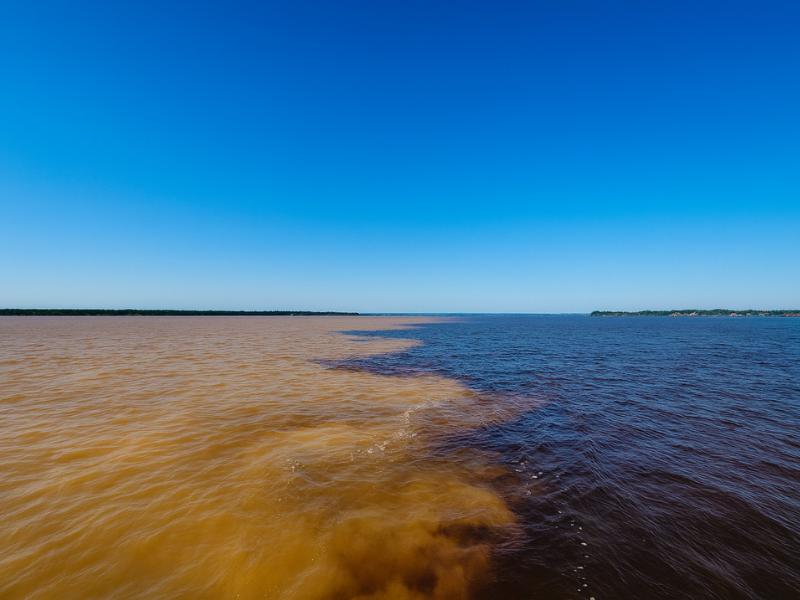
Just outside Manaus, two enormous rivers collide and then refuse to blend, running side by side for several kilometers with a visible line between black water and sandy brown. The effect looks like a trick of the light from a plane and like a physical boundary from a boat. Here is what is actually happening.
Choose a private confluence outing or a wider river day. Explore Private Meeting Of The Waters And Janauary Lake ↗
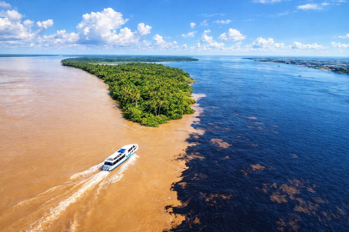
From the deck of a boat it looks staged. On one side the water is dark and still enough to hold a reflection, on the other it is pale, sandy and moving faster, and between them runs a boundary sharp enough that you can trail a hand across it. This is the Encontro das Aguas, just downstream of Manaus, and it is the most reliably astonishing thing in the Brazilian Amazon that does not require an animal to cooperate.
What is the Meeting of the Waters?
The Meeting of the Waters is the confluence just outside Manaus where the dark Rio Negro joins the pale Rio Solimoes and the two flows continue side by side, visibly separate, for roughly 6 kilometers (3.7 miles) before they mix. The rivers stay apart because they differ in temperature, speed, density and what they are carrying, not because of any single cause. Downstream of the confluence, the combined flow continues as the Amazon River proper.
Trip choice: Explore the confluence, floating village and Janauary waterways in a covered speedboat with a guide for your group. Explore This 4 hours Experience ↗
The Rio Negro arrives dark, cool, acidic and almost free of sediment. Its tea color comes from dissolved organic matter leached out of the forest it drains. The Rio Solimoes arrives paler, warmer, faster and thick with sediment eroded off the Andes and carried east across the continent. Two rivers, two entirely different histories, meeting at a point you can reach from a hotel breakfast in under an hour.
Why do the two rivers not mix?
Because they differ in several properties at once. The Rio Negro is cooler, slower and less dense; the Rio Solimoes is warmer, faster and carries a heavy sediment load. Those differences in temperature, speed, density and chemical composition keep the two flows apart until turbulence, wind and the river's own bends finally blend them.
No single one of those factors would hold the line by itself. It is the combination that does it, which is why explanations that reduce it to "different temperatures" or "different densities" always feel slightly unsatisfying. As IFLScience sets out in its explainer on the phenomenon, the two rivers behave for a while like two separate systems occupying the same channel, and only mixing forces applied over distance break that down.
| Property | Rio Negro | Rio Solimoes |
|---|---|---|
| Color | Dark, tea colored, almost black in bulk | Pale sandy yellow |
| Where the color comes from | Dissolved organic matter from forest drainage | Suspended sediment eroded off the Andes |
| Temperature | Cooler | Warmer |
| Speed | Slower | Faster |
| Sediment load | Near sediment free | Heavy |
| Chemistry | Acidic | Less acidic, mineral rich |
The stretch where they run together is about 6 kilometers, or 3.7 miles. That is the distance most often cited, and it is worth knowing before you go, because the phenomenon is not a single point you sail past in thirty seconds. It is a corridor, and a boat can sit in it.
Where is it, and how do you actually see it?
The confluence sits immediately downstream of Manaus, in the Brazilian state of Amazonas. Nearly every river tour from the city visits it, usually as the first stop of the morning, and multi-day trips heading south to the lodges pass straight through it on the transfer.
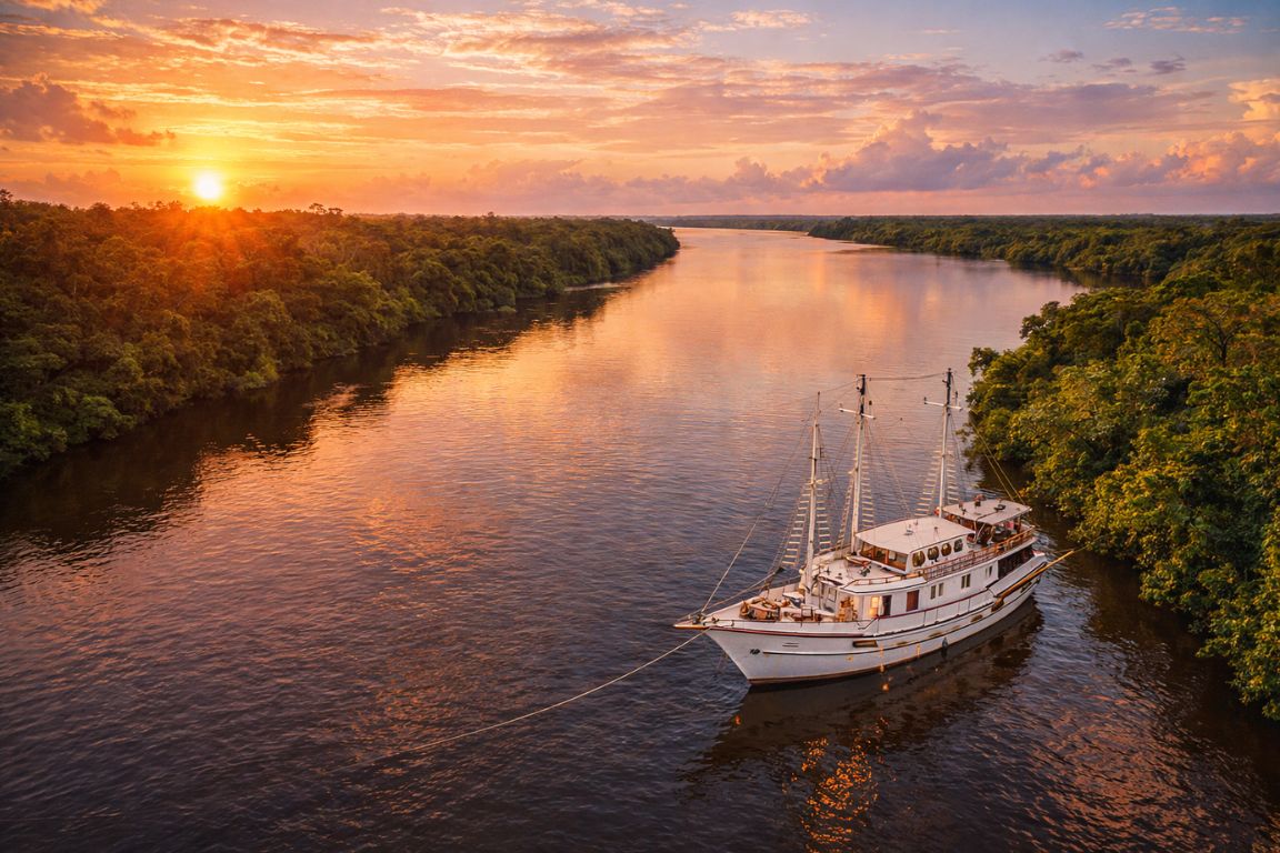
Boat is the way to see it properly. From the water you get the vantage point where the line runs away from the hull toward the horizon, and you can feel the temperature difference if you put a hand in on each side. Most morning departures reach it about an hour after leaving the city, which puts you there while the light is still low enough to keep the contrast strong.
| Trip | Length | How the confluence fits in | Price from |
|---|---|---|---|
| Meeting of the Waters tour with pink dolphins and lunch | About 6 hours | The headline stop, paired with a dolphin swim, an indigenous village visit and lunch | $75 |
| Amazon jungle safari from Manaus | About 6.5 hours | First stop, then Janauary Ecological Park, a Tuyuka community visit and a buffet lunch | $38 |
| Multi-day floating lodge and survival trips | 3 to 5 days | Passed on the day-one speedboat transfer south toward the Juma and Mamori rivers | $500 |
Prices are the starting figures on the operators' own listings and shift with season and group size. If your time in Manaus is short, the Meeting of the Waters tour with pink dolphins and lunch is the most direct way to see it: pickup from your hotel, boat out to the confluence, a swim with the dolphins, lunch, and back in the city by mid afternoon.
What does it look like in person?
Sharper than photographs suggest. The boundary is not a gentle gradient but a ragged, moving seam, with swirls and eddies where the two waters push against each other, and it holds for kilometers rather than meters.
Guests consistently describe it as the moment of the day, and the boat's vantage point is what makes it work. Guides usually slow or stop the vessel so people can photograph along the line rather than across it, which is the shot that reads properly on a phone. Overcast light flattens the contrast a little, but the difference between black water and sandy brown survives most weather.
One honest caveat: this is a river phenomenon, not a viewpoint with a railing. You are looking at moving water, the boundary shifts and wanders, and how dramatic it looks on any given morning depends on light, water levels and how much sediment the Solimoes is carrying that week. It is a natural process rather than an exhibit, which is precisely why it is worth seeing.
When is the best time to go?
It runs year round. The confluence is a permanent feature rather than a seasonal one, so the choice of month is really a choice about everything else you want to do while you are there.
Water levels change with the season, and that changes the wider trip more than it changes the line itself. Between May and October the water is lower, trails are easier and wildlife concentrates along the river. From November to April the forest floods, giant water lilies are at their most spectacular in the ecological parks, and canoe routes open up between the trees. Our guide to the best time to visit works through the trade-offs month by month.
Morning departures are the norm for a reason. Low light keeps the contrast strong, the river is calmer earlier, and starting at the confluence leaves the rest of the day for the dolphins, the forest walk and lunch.