Where Is the Amazon Rainforest? A Geography Guide for Travelers
The Amazon is not one country's forest and not one place on a map. It stretches across nine South American countries, covers something in the region of 2.3 to 2.6 million square miles, and about 60 percent of it sits inside Brazil. This guide sorts out the geography, then turns it into something you can actually plan a trip around.
Start with Manaus, then decide how far and how long to go. Explore Private Meeting Of The Waters And Janauary Lake ↗
Ask ten travelers to point at the Amazon on a world map and most will put a finger somewhere over Brazil. They are mostly right, and they are also missing roughly forty percent of it. The forest crosses nine countries, sits astride a river system that drains a large part of a continent, and is big enough that two people can both say they went to the Amazon while meaning places a thousand miles apart. What follows sorts out the map first, then answers the question underneath the question: where do you actually go?
Who holds the Amazon: share of the rainforest by country
Shares are approximate and rounded. Brazil holds about 60 percent of the Amazon rainforest, Peru about 13 percent and Colombia about 10 percent, with the remainder split among six more countries. Compiled from Britannica and WWF; published totals shift slightly depending on where each source draws the forest boundary, which is also why the overall area is best given as a range.
The short answer
The Amazon rainforest lies in northern South America and spans nine countries: Brazil, Peru, Bolivia, Ecuador, Colombia, Venezuela, Guyana, Suriname and French Guiana. It covers roughly 2.3 to 2.6 million square miles, about 6 to 6.7 million square kilometers, and close to 60 percent of it sits inside Brazil. Peru holds around 13 percent and Colombia around 10 percent. For most travelers heading to the Brazilian side, the practical door is Manaus, a city in Amazonas state on the Rio Negro, right where that river meets the Rio Solimoes.
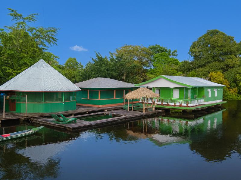
Trip choice: Explore the confluence, floating village and Janauary waterways in a covered speedboat with a guide for your group. Explore This 4 hours Experience ↗
Where exactly is the Amazon rainforest?
The Amazon rainforest fills the basin drained by the Amazon River and its tributaries, in the northern half of South America, straddling the equator. It runs from the eastern flank of the Andes across the continent toward the Atlantic, covering roughly 2.3 to 2.6 million square miles in nine countries.
The simplest way to hold it in your head is to follow the water rather than the borders. Everything about the region's shape is set by rivers: where they rise, which way they run, how much silt they carry, and how far they spill sideways into the trees every wet season. At Manaus you can watch two of them arrive from completely different worlds. The Rio Solimoes turns up pale and sandy, heavy with sediment ground off the Andes far to the west. The Rio Negro turns up dark, acidic and almost free of sediment, its tea color coming from dissolved organic matter leached out of the forest itself.
They meet just outside the city and continue east as the Amazon River proper. That confluence is the famous Meeting of the Waters, where the two flows run side by side for about 6 kilometers, 3.7 miles, before they finally blend. It is also the cleanest possible illustration of Amazon geography: one forest, fed by water with completely different chemistry depending on which direction it came from.
| River | Water | Where it comes from | Where you meet it |
|---|---|---|---|
| Rio Negro | Dark, tea colored, acidic, cooler and slower, nearly sediment free | Forest drainage; the color is dissolved organic matter | Manaus sits on it; city boats leave from its banks |
| Rio Solimoes | Pale sandy yellow, warmer, faster, heavy with sediment | Andean erosion, carried east | Just outside Manaus, at the confluence |
| Amazon River | The combined flow, sediment dominant | Both of the above, plus thousands of tributaries | Everything downstream of Manaus, running toward the Atlantic |
That is why the question has no tidy border answer. The forest is defined by a drainage basin, not by a fence, and different institutions draw the line in slightly different places. What every source agrees on is the center of gravity: northern South America, mostly Brazil, with the western edge climbing toward the Andes and the northeastern edge running out to the Guianas.
What countries make up the Amazon rainforest?
Nine countries hold a piece of the Amazon: Brazil, Peru, Bolivia, Ecuador, Colombia, Venezuela, Guyana, Suriname and French Guiana. Brazil's share is by far the largest at roughly 60 percent, with Peru at about 13 percent and Colombia at about 10 percent. The remaining six split what is left between them.
The imbalance matters more than it sounds. Because Brazil holds the majority of the forest, it also holds the majority of the infrastructure built to reach it: the airports, the river ports, the lodge operators and the guides. That is a practical fact, not a value judgment. A traveler with a week to spend and no strong preference will find far more organized options on the Brazilian side simply because there is more forest there and more of a tourism economy around it.
| Country | Share of the forest | Roughly where it sits |
|---|---|---|
| Brazil | About 60 percent | The central and eastern bulk, draining toward the Atlantic |
| Peru | About 13 percent | The western headwaters, against the Andes |
| Colombia | About 10 percent | The northwest |
| Bolivia | Part of the remaining share | The southwest |
| Ecuador | Part of the remaining share | The far west, below the mountains |
| Venezuela | Part of the remaining share | The north |
| Guyana | Part of the remaining share | The northeast, toward the Atlantic coast |
| Suriname | Part of the remaining share | The northeast |
| French Guiana | Part of the remaining share | The northeast, an overseas department of France |
Published country-by-country percentages for the six smaller shareholders vary depending on how each source draws the forest boundary, so we have not invented precise figures for them. The three big shares are the ones that are consistently reported, and between them they account for the large majority of the forest.
No tour booking answers this specific question. Use this information to set your requirements before choosing an itinerary.
How big is the Amazon rainforest?
Roughly 2.3 to 2.6 million square miles, or about 6 to 6.7 million square kilometers. Sources publish slightly different totals because they draw the forest boundary differently, some counting the closed-canopy rainforest and others the wider river basin, so a range is more honest than a single number.
| Estimate | Square miles | Square kilometers | Why it lands there |
|---|---|---|---|
| Lower end of published figures | About 2.3 million | About 6.0 million | A tighter definition of the forest itself |
| Upper end of published figures | About 2.6 million | About 6.7 million | A wider basin boundary, including transitional edges |
Numbers that large stop meaning anything, so it helps to convert the scale into distances you would actually travel. From Manaus, a full day in the jungle starts with a drive of about an hour west to the Castanho Lake area, and you are already in dense forest with canals and trails. The floating lodges on the Juma and Mamori rivers sit around 100 kilometers south of the city, and reaching them takes a speedboat, a road transfer and another speedboat. Head upriver on the Rio Negro instead and you reach the Anavilhanas Archipelago, the largest freshwater archipelago in the world, where the river spreads as wide as 27 kilometers across a maze of islands and channels.
None of those trips scratches the surface. All three are within a few hours of a single city, in a single state, in a single one of the nine countries. That is the useful thing to take from the size figure: nobody visits the Amazon, they visit a specific corner of it, and choosing which corner is most of the planning work.
Is the Amazon rainforest all in Brazil?
No. About 60 percent of the Amazon lies inside Brazil, which means roughly two fifths of it does not. Peru holds around 13 percent, Colombia around 10 percent, and six more countries share the rest. Brazil dominates the conversation because it holds the largest slice and the busiest visitor gateways, not because it holds the whole forest.
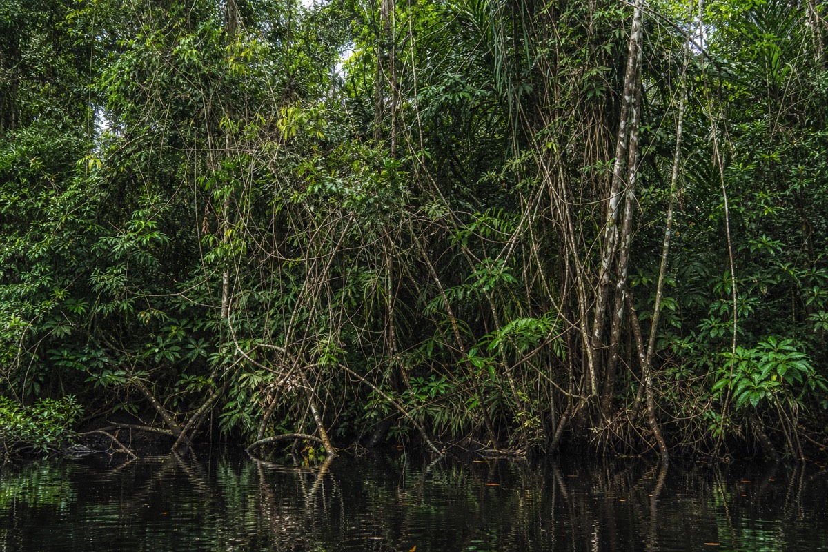
The distinction shows up in real trip planning more often than you would expect. Our own tour catalogue spans two of the nine countries. Most of it departs from Manaus in Brazil, which is where the Meeting of the Waters, the floating lodges and the pink dolphin platforms are. A couple of trips depart instead from Leticia, on the Colombian side, where the walking is through a different reserve, the community lunch is at Maloka Cuchira, and the birding is the main event rather than the river.
Those are genuinely different holidays. Same forest, different water, different communities, different flights. If someone tells you they have been to the Amazon, the follow up question worth asking is which country and which river, because the answers change nearly everything about what they saw.
No tour booking answers this specific question. Use this information to set your requirements before choosing an itinerary.
Where is Manaus, and why does every Brazilian Amazon trip start there?
Manaus is a city in the Brazilian state of Amazonas, sitting on the north bank of the Rio Negro just above its confluence with the Rio Solimoes. It is not near the rainforest, it is inside it, which is why it works as a base: you can sleep in a hotel with air conditioning and be on a jungle trail a couple of hours later.
The city exists because of the river. Its most famous building, the Teatro Amazonas opera house, went up during the late nineteenth century rubber boom, when Amazonian latex briefly made this remote river port extraordinarily rich. Ponta Negra is the riverside beach and promenade area where the city goes in the evening, and the Mercado Municipal Adolpho Lisboa is the historic central market. Flights arrive at Eduardo Gomes International Airport, code MAO, which is the practical entry point for almost every visitor.
| Manaus at a glance | Detail |
|---|---|
| Country and state | Brazil, state of Amazonas |
| River | On the Rio Negro, just above the Rio Solimoes confluence |
| Airport | Eduardo Gomes International Airport (MAO) |
| Signature landmark | Teatro Amazonas, the rubber boom opera house |
| Riverside district | Ponta Negra |
| Historic market | Mercado Municipal Adolpho Lisboa |
| Why tours start here | Operators pick up and drop off at city hotels; some multi-day trips collect from the airport |
Opening hours and ticket prices for the city's attractions change, so check them close to your travel dates rather than trusting a number in an article. What does not change is the geography: everything in the Brazilian Amazon tourism map radiates outward from this one point on the Rio Negro.
What is the closest major city to the Amazon rainforest?
For the Brazilian Amazon, Manaus. It is the largest city inside the forest and the one nearly every guided trip uses as its base, with hotel pickups, river ports and an international airport all in the same place. Peru, Colombia and Ecuador each have their own gateway towns reaching their own sections of the forest.
The phrase "closest city" is slightly misleading in the Amazon, because the forest surrounds the cities rather than starting somewhere beyond their suburbs. From a Manaus hotel, an evening tour can have you on the water in under an hour, watching stilt houses slide past on the way to Iranduba. A full day trip drives about an hour west and puts you on a jungle trail before mid morning. There is no long approach journey to endure first.
Which gateway suits you depends on what you want to see rather than which is closest to anything. The Brazilian side around Manaus is the one with the two-colored river confluence, the pink river dolphin platforms and the floating lodges. Other countries reach parts of the forest with their own character and their own specialties. Choose the experience, then choose the gateway that serves it.
Where do Amazon tours from Manaus actually take you?
Guided trips fan out in four directions from Manaus: east to the river confluence, west by road to the lakes and canals around Castanho, north and upriver on the Rio Negro, and south to the Juma and Mamori rivers where the floating lodges sit. Each direction is a different landscape and a different day.
| Where | Distance from Manaus | What is there | Typical trip |
|---|---|---|---|
| The river confluence | Just outside the city | Two rivers running side by side for about 6 km before mixing | Half day and full day river tours; most multi-day transfers pass it |
| Janauary Ecological Park | Reached by boat from the city | Suspended walkways, giant kapok trees, the water lily lake | Jungle safari from Manaus |
| Iranduba | About 30 to 45 minutes by boat | Stilt houses, riverside communities, piranha waters | Evening tour with piranha fishing and an alligator watch |
| Castanho Lake area | About an hour west by road | Trails, narrow canals, a dolphin platform, floating house lunch | Full day jungle tours |
| Anavilhanas Archipelago | Upriver on the Rio Negro | The largest freshwater archipelago in the world; the river spreads up to 27 km wide | Full day jungle trek and cruise |
| Juma and Mamori rivers | About 100 km south | Floating lodges, flooded forest, sunrise canoe water | 3-day and multi-day lodge stays |
| Igarape-Acu channels | Remote, reached by transfer and paddle | Narrow creeks and flooded forest, wilderness camps | Multi-day kayak expedition |
Read that table as a map of trade-offs rather than a list of places. Everything close to the city is easy to add to a short stay and easy to combine. Everything far from the city takes a chunk of your itinerary to reach and pays you back in quiet, in wildlife that has not learned to avoid boat engines, and in nights spent listening to the forest instead of the traffic.
How does the geography change with the season?
The Amazon's map is not fixed. In the wet season the forest floods and the water rises high into the trees, opening up channels you can paddle between trunks. In the dry season the water drops, trails reappear, beaches emerge and wildlife concentrates around what water is left.
| Season | Approximate months | What the water does | What that opens up | The trade-off |
|---|---|---|---|---|
| Dry | May to October | Levels drop | Easier trails, more wildlife visible along the river | Cooler nights |
| Wet | November to April | Forest floods | Lush growth, flooded forest to canoe through, water lilies at their best | Muddy trails, higher water, more insects |
Operators adjust their days around this rather than fighting it. The same multi-day lodge trip runs canoe routes through flooded forest when the water is high and swaps to walking trails when it drops. If your dates are flexible, our guide to the best time to visit goes through the month-by-month picture in detail. If they are not, the honest position is that both seasons work and they simply deliver different days.
How much of the forest can you reach on a short trip?
More than most people assume. A half day gets you to the river confluence and the ecological park. A full day gets you an hour west into trails, canals and a floating house lunch. Two or three days gets you 100 kilometers south to a lodge on the Juma. Four or five days gets you into channels with no other boats on them.
| Trip length | Example | How deep you get | Price from |
|---|---|---|---|
| 5 to 6 hours | Evening piranha and caiman tour; Meeting of the Waters with lunch; jungle safari | The city's own river and the confluence | $38 |
| 8 to 12 hours | A Whole Day in the Brazilian Amazon Jungle; the Anavilhanas trek | An hour west by road, or upriver to the archipelago | $100 |
| 2 days | Overnight rainforest experience | A night at a floating house, with sunrise wildlife | $300 |
| 3 days | 3-day wildlife, culture and pink dolphins adventure | Floating lodge on the Juma, about 100 km south | $500 |
| 4 to 5 days | Kayak expedition; survival trip with camping; Tapiri floating lodge stay | Remote channels, hammock camps, minimal other visitors | $659 |
Prices above are the starting figures from the operators' own listings and move with season and group size, so treat them as an order of magnitude rather than a quote. The pattern is what matters: the jump in remoteness between a day trip and a three-day lodge stay is much bigger than the jump between three days and five. If you are weighing that up, our guide to how many days you need works through it properly.
Turning the map into a trip
Geography is the part of Amazon planning that people skip and then regret. The forest is enormous, it belongs to nine countries, and the version you experience depends entirely on which river you end up on and how far from a city you are willing to sleep. Decide the country first, then the gateway, then the depth. For the Brazilian side that sequence almost always resolves to Manaus, because that is where the flights land, where the two rivers meet and where the boats leave from.
From there it becomes a question of time rather than distance. A day is enough to stand in real jungle, eat lunch on a floating house and watch caimans in a spotlight beam after dark. Three days puts a hundred kilometers of river between you and the nearest streetlight. When you are ready to move from reading the map to booking something on it, Brazilian Amazon Tours lists the guided trips that leave from Manaus, and our walkthrough on planning a trip to the Amazon covers the practical steps in order.